Geophysics
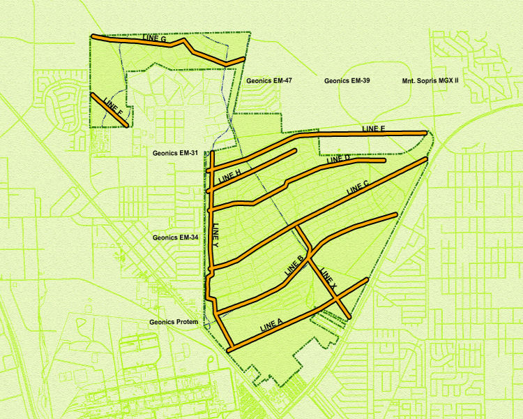
Geophysical investigations at the site were used to map potential paleochannels in the Muddy Creek formation with a secondary objective to map the approximate elevation of the Muddy Creek formation across the site. Several geophysical techniques were used, including the time domain electromagnetic (TDEM) geophysical method. Click on a line to see the geoelectric cross-section for the smooth model inversion profiles for that line. Several pictures also show the geophysical equipment in use.